Toggle navigation
Survey Documents
Advanced Search
Supporting Data
Companies
Surveyors
Communities
Original Townships
APIs
Survey Documents API
Tutorial
About
Contact
Search
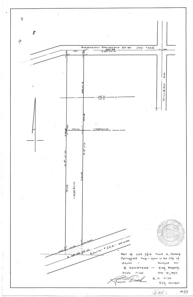
3171-2
Download f1655.tif
GIS Data
Latitude:
41.0305819999999
Longitude:
-81.456242
Identification
Survey identifier:
3171-2
Context
Original township:
Springfield
Community list:
Akron
Surveyed on:
11/16/1953
Description
Owner:
Konstand
Description:
Primary road:
S.R. 224
Secondary road:
Barberton Springfield Rd
Near intersection:
Hillbish Ave
Acreage:
1.7658
Survey Locators
Tract list:
4
Lot list:
5, 6
Section list:
Quarter:
Surveyor
Surveyor number:
3874
Surveyor name:
Fish, R.C.
Company:
Document Data
Scan File Name:
f1655.tif
Scan Pages:
1
Drawer location: