Toggle navigation
Survey Documents
Advanced Search
Supporting Data
Companies
Surveyors
Communities
Original Townships
APIs
Survey Documents API
Tutorial
About
Contact
Search
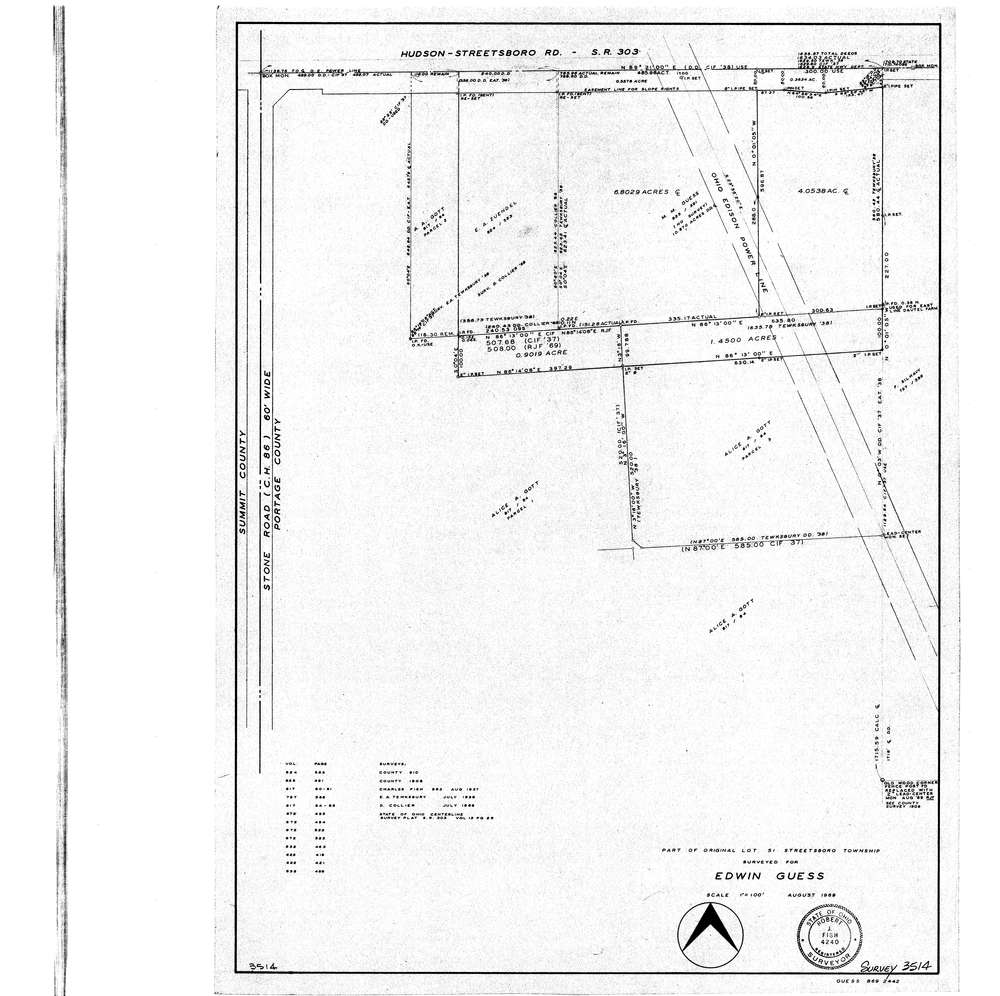
3514
Download lotsplits3514.tif
GIS Data
Latitude:
41.2392219999999
Longitude:
-81.388907
Identification
Survey identifier:
3514
Context
Original township:
Community list:
Surveyed on:
08/01/1969
Description
Owner:
Guess
Description:
Primary road:
Stone Rd
Secondary road:
Near intersection:
Hudson-Streetsboro Rd
Acreage:
Survey Locators
Tract list:
Lot list:
51
Section list:
Quarter:
Surveyor
Surveyor number:
4240
Surveyor name:
Fish, Robert J.
Company:
Document Data
Scan File Name:
lotsplits3514.tif
Scan Pages:
1
Drawer location:
015