Toggle navigation
Survey Documents
Advanced Search
Supporting Data
Companies
Surveyors
Communities
Original Townships
APIs
Survey Documents API
Tutorial
About
Contact
Search
10299
Download lotsplits10299.tif
GIS Data
Latitude:
41.0598409999998
Longitude:
-81.410837
Identification
Survey identifier:
10299
Context
Original township:
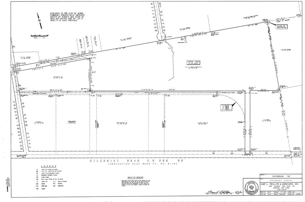
Springfield
Community list:
Akron
Surveyed on:
03/31/1993
Description
Owner:
AC & Y Terminal Properties
Description:
Boundary Survey
Primary road:
Gilchrist Rd
Secondary road:
Broadview Rd
Near intersection:
Munroe Falls Rd
Acreage:
34.275
Survey Locators
Tract list:
8
Lot list:
17
Section list:
Quarter:
Surveyor
Surveyor number:
7189
Surveyor name:
Phillips, Gary L.
Company:
Gary L. Phillips & Associates
Document Data
Scan File Name:
lotsplits10299.tif
Scan Pages:
1
Drawer location:
003