Toggle navigation
Survey Documents
Advanced Search
Supporting Data
Companies
Surveyors
Communities
Original Townships
APIs
Survey Documents API
Tutorial
About
Contact
Search
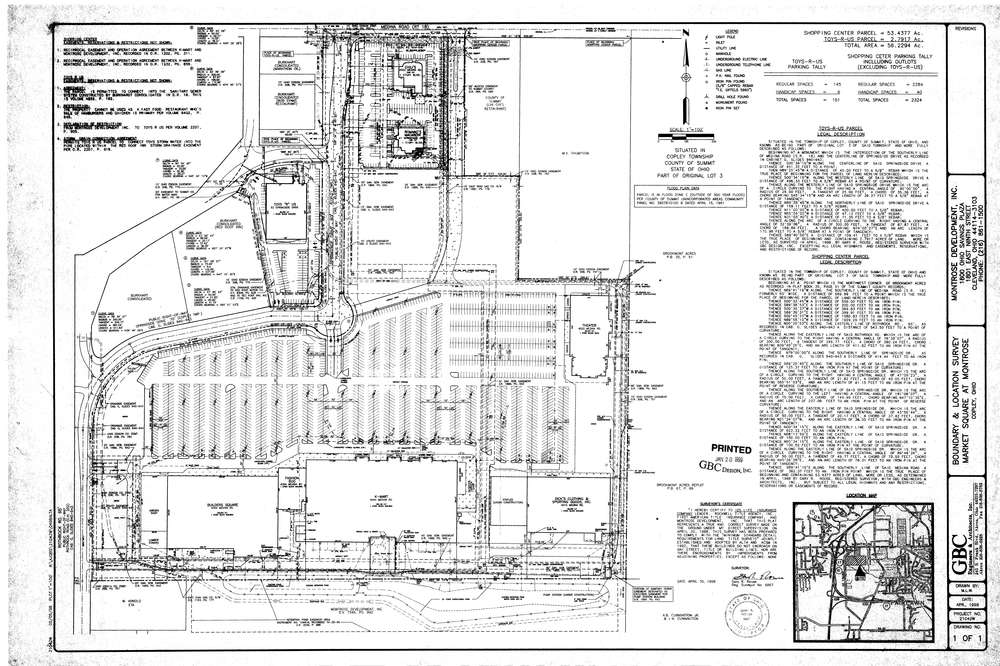
10301
Download market_square_01.TIF
GIS Data
Latitude:
41.1327389999999
Longitude:
-81.644897
Identification
Survey identifier:
10301
Context
Original township:
Copley
Community list:
Surveyed on:
01/20/1999
Description
Owner:
Montrose Development
Description:
Boundary Location Survey
Primary road:
Springside
Secondary road:
Rothrock
Near intersection:
Medina Road (SR 18)
Acreage:
53.4377
Survey Locators
Tract list:
Lot list:
3
Section list:
Quarter:
Surveyor
Surveyor number:
Surveyor name:
Company:
GBC Engineers & Architects,Inc
Document Data
Scan File Name:
market_square_01.TIF
Scan Pages:
1
Drawer location:
003