Toggle navigation
Survey Documents
Advanced Search
Supporting Data
Companies
Surveyors
Communities
Original Townships
APIs
Survey Documents API
Tutorial
About
Contact
Search
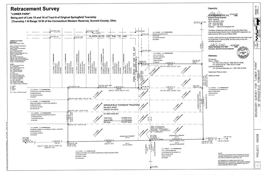
10303
Download survey_10303.TIF
GIS Data
Latitude:
41.0627859999998
Longitude:
-81.405859
Identification
Survey identifier:
10303
Context
Original township:
Springfield
Community list:
Surveyed on:
06/24/2009
Description
Owner:
Springfield Township
Description:
"Lower Park"
Primary road:
Fenn Dr
Secondary road:
Near intersection:
Klages Blvd
Acreage:
13.6306
Survey Locators
Tract list:
8
Lot list:
15, 16
Section list:
Quarter:
Surveyor
Surveyor number:
Surveyor name:
Company:
County Of Summit Engineer
Document Data
Scan File Name:
survey_10303.TIF
Scan Pages:
1
Drawer location:
003