Toggle navigation
Survey Documents
Advanced Search
Supporting Data
Companies
Surveyors
Communities
Original Townships
APIs
Survey Documents API
Tutorial
About
Contact
Search
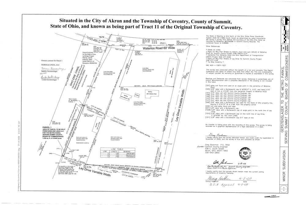
10307
Download survey_10307.TIF
GIS Data
Latitude:
41.0272399999999
Longitude:
-81.539047
Identification
Survey identifier:
10307
Context
Original township:
Coventry
Community list:
Surveyed on:
11/01/2008
Description
Owner:
Norm and Linda LLC
Description:
Split for Metro Park Trail
Primary road:
Ley Drive
Secondary road:
Near intersection:
Waterloo Rd
Acreage:
0.0444
Survey Locators
Tract list:
11
Lot list:
Section list:
Quarter:
Surveyor
Surveyor number:
Surveyor name:
Company:
County Of Summit Engineer
Document Data
Scan File Name:
survey_10307.TIF
Scan Pages:
1
Drawer location:
003