Toggle navigation
Survey Documents
Advanced Search
Supporting Data
Companies
Surveyors
Communities
Original Townships
APIs
Survey Documents API
Tutorial
About
Contact
Search
10314
Download survey_10314.TIF
GIS Data
Latitude:
41.3165779999999
Longitude:
-81.567714
Identification
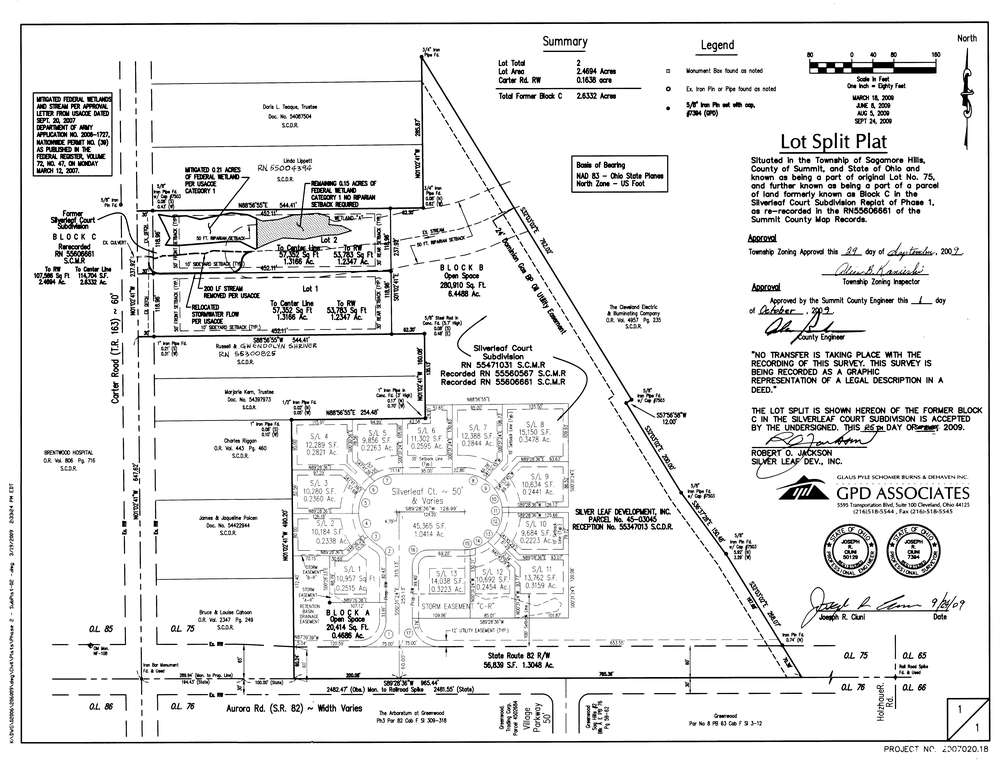
Survey identifier:
10314
Context
Original township:
Northfield
Community list:
Surveyed on:
10/01/2009
Description
Owner:
Jackson, Robert
Description:
Part of Block C Silverleaf Sub. RN55606661
Primary road:
Carter Rd
Secondary road:
Near intersection:
SR 82 - Aurora Road
Acreage:
1.3166
Survey Locators
Tract list:
Lot list:
75
Section list:
Quarter:
Surveyor
Surveyor number:
Surveyor name:
Company:
GPD Associates
Document Data
Scan File Name:
survey_10314.TIF
Scan Pages:
1
Drawer location:
003