Toggle navigation
Survey Documents
Advanced Search
Supporting Data
Companies
Surveyors
Communities
Original Townships
APIs
Survey Documents API
Tutorial
About
Contact
Search
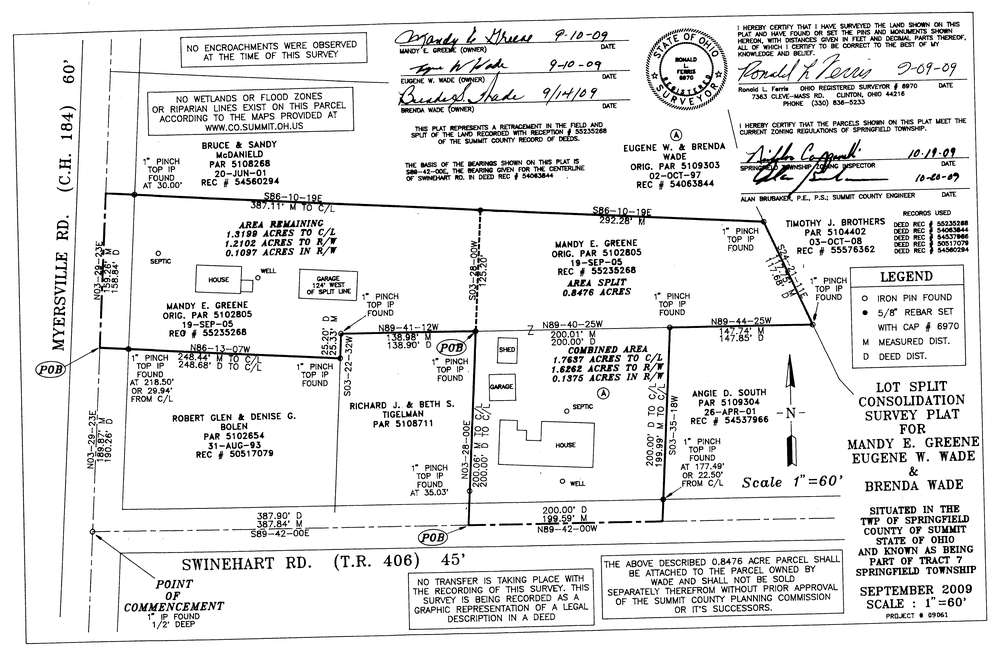
10315
Download survey_10315.TIF
GIS Data
Latitude:
41.0112689999998
Longitude:
-81.428883
Identification
Survey identifier:
10315
Context
Original township:
Springfield
Community list:
Surveyed on:
10/20/2009
Description
Owner:
Green and Wade
Description:
Split and Consolidation
Primary road:
Myersville Rd
Secondary road:
Near intersection:
Swinehart Rd
Acreage:
1.7637
Survey Locators
Tract list:
7
Lot list:
Section list:
Quarter:
Surveyor
Surveyor number:
Surveyor name:
Company:
Document Data
Scan File Name:
survey_10315.TIF
Scan Pages:
1
Drawer location:
003