Toggle navigation
Survey Documents
Advanced Search
Supporting Data
Companies
Surveyors
Communities
Original Townships
APIs
Survey Documents API
Tutorial
About
Contact
Search
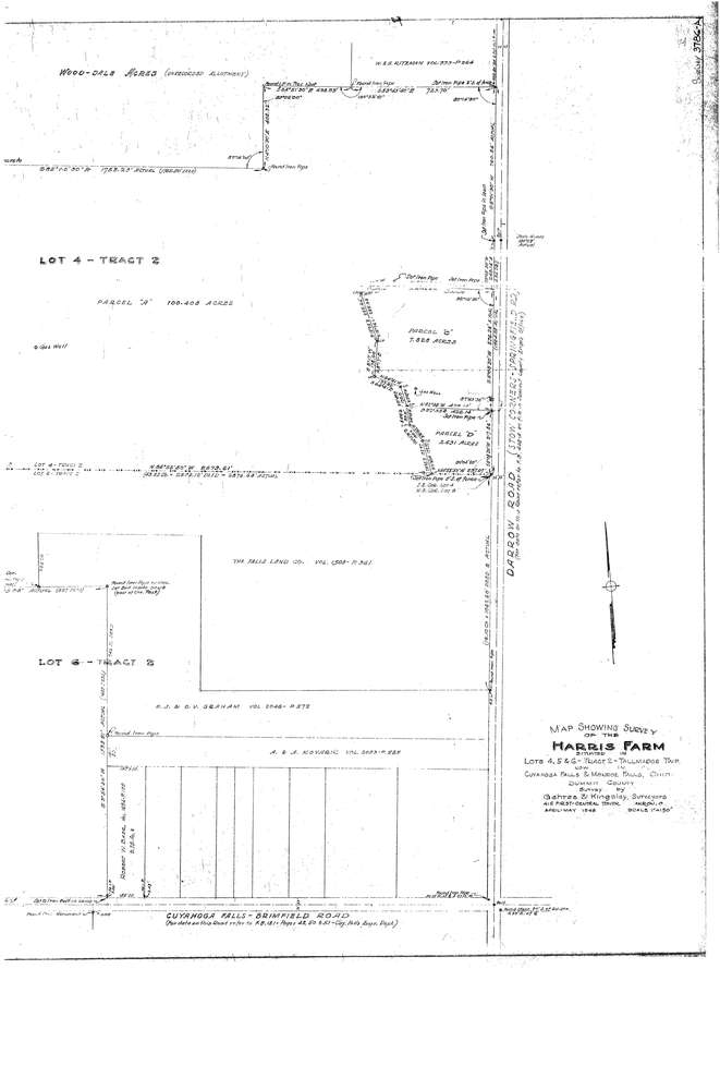
3786 2 pages scanned, please download to view all scans
Download lotsplits3786.tif
GIS Data
Latitude:
41.1220389999998
Longitude:
-81.446114
Identification
Survey identifier:
3786
Context
Original township:
Tallmadge
Community list:
Surveyed on:
05/01/1946
Description
Owner:
Harris
Description:
Harris Farm
Primary road:
Darrow Rd
Secondary road:
Howe Rd
Near intersection:
Acreage:
100.0
Survey Locators
Tract list:
2
Lot list:
4, 5, 6
Section list:
Quarter:
Surveyor
Surveyor number:
Surveyor name:
Company:
Gehres & Kingsley, Surveyors
Document Data
Scan File Name:
lotsplits3786.tif
Scan Pages:
2
Drawer location:
016