Toggle navigation
Survey Documents
Advanced Search
Supporting Data
Companies
Surveyors
Communities
Original Townships
APIs
Survey Documents API
Tutorial
About
Contact
Search
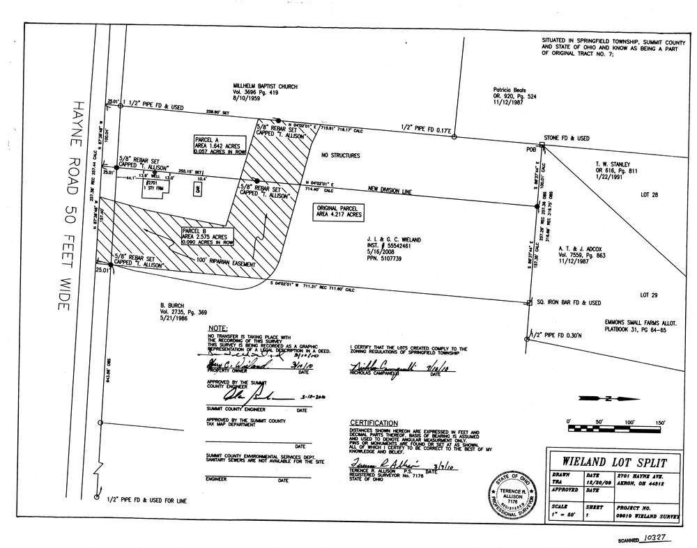
10327
Download survey_10327.TIF
GIS Data
Latitude:
41.0042569999998
Longitude:
-81.426373
Identification
Survey identifier:
10327
Context
Original township:
Springfield
Community list:
Surveyed on:
03/09/2010
Description
Owner:
Wieland
Description:
2701 Hayne Road
Primary road:
Hayne Rd
Secondary road:
Near intersection:
Myersville Rd
Acreage:
4.217
Survey Locators
Tract list:
7
Lot list:
Section list:
Quarter:
Surveyor
Surveyor number:
Surveyor name:
Company:
Document Data
Scan File Name:
survey_10327.TIF
Scan Pages:
1
Drawer location:
003