Toggle navigation
Survey Documents
Advanced Search
Supporting Data
Companies
Surveyors
Communities
Original Townships
APIs
Survey Documents API
Tutorial
About
Contact
Search
10339
Download survey_10339.TIF
GIS Data
Latitude:
41.2806609999999
Longitude:
-81.512032
Identification
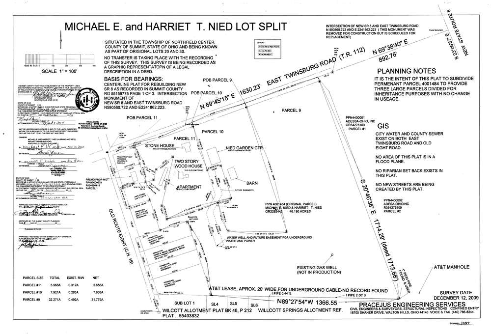
Survey identifier:
10339
Context
Original township:
Northfield
Community list:
Surveyed on:
12/12/2009
Description
Owner:
Nied, Michael and Harriet
Description:
Split into 3 parcels
Primary road:
Twinsburg Rd
Secondary road:
Near intersection:
Olde Eight Road
Acreage:
32.271
Survey Locators
Tract list:
Lot list:
20, 30
Section list:
Quarter:
Surveyor
Surveyor number:
Surveyor name:
Company:
Document Data
Scan File Name:
survey_10339.TIF
Scan Pages:
1
Drawer location:
003