Toggle navigation
Survey Documents
Advanced Search
Supporting Data
Companies
Surveyors
Communities
Original Townships
APIs
Survey Documents API
Tutorial
About
Contact
Search
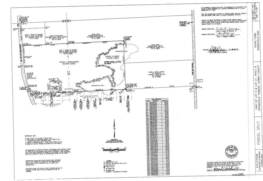
10336
Download survey_10336.TIF
GIS Data
Latitude:
41.0065569999999
Longitude:
-81.401353
Identification
Survey identifier:
10336
Context
Original township:
Springfield
Community list:
Surveyed on:
11/18/2010
Description
Owner:
Young, Dale and Dean
Description:
Springfield Bog to Metroparks
Primary road:
Canton Rd
Secondary road:
Portage Line Rd
Near intersection:
Acreage:
17.8722
Survey Locators
Tract list:
8
Lot list:
4, 27
Section list:
Quarter:
Surveyor
Surveyor number:
Surveyor name:
Company:
Kalstrom Surveying & Mapping
Document Data
Scan File Name:
survey_10336.TIF
Scan Pages:
1
Drawer location:
003