Toggle navigation
Survey Documents
Advanced Search
Supporting Data
Companies
Surveyors
Communities
Original Townships
APIs
Survey Documents API
Tutorial
About
Contact
Search
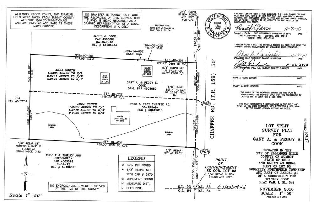
10337
Download survey_10337.tif
GIS Data
Latitude:
41.3302749999999
Longitude:
-81.578958
Identification
Survey identifier:
10337
Context
Original township:
Northfield
Community list:
Surveyed on:
11/22/2010
Description
Owner:
Cook, Gary and Peggy
Description:
Split
Primary road:
Chaffee Rd
Secondary road:
Near intersection:
Nesbitt Rd
Acreage:
1.0335
Survey Locators
Tract list:
Lot list:
93
Section list:
Quarter:
Surveyor
Surveyor number:
Surveyor name:
Company:
Document Data
Scan File Name:
survey_10337.tif
Scan Pages:
1
Drawer location:
003