Toggle navigation
Survey Documents
Advanced Search
Supporting Data
Companies
Surveyors
Communities
Original Townships
APIs
Survey Documents API
Tutorial
About
Contact
Search
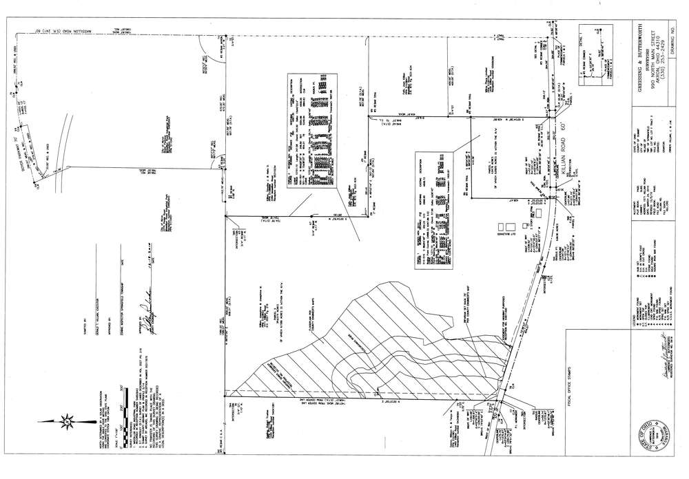
10340
Download survey_10340.TIF
GIS Data
Latitude:
40.9956739999998
Longitude:
-81.467786
Identification
Survey identifier:
10340
Context
Original township:
Springfield
Community list:
Surveyed on:
12/14/2010
Description
Owner:
Killian, Gerald
Description:
1571 Killian Road
Primary road:
Killian Rd
Secondary road:
Boyer Prkwy
Near intersection:
Acreage:
4.047
Survey Locators
Tract list:
3
Lot list:
F
Section list:
Quarter:
Surveyor
Surveyor number:
Surveyor name:
Company:
Greissing & Butterworth
Document Data
Scan File Name:
survey_10340.TIF
Scan Pages:
1
Drawer location:
003