Toggle navigation
Survey Documents
Advanced Search
Supporting Data
Companies
Surveyors
Communities
Original Townships
APIs
Survey Documents API
Tutorial
About
Contact
Search
10342 5 pages scanned, please download to view all scans
Download survey_10342.tif
GIS Data
Latitude:
41.0141259999998
Longitude:
-81.523243
Identification
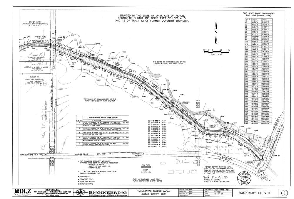
Survey identifier:
10342
Context
Original township:
Coventry
Community list:
Surveyed on:
10/23/2001
Description
Owner:
ODNR
Description:
Tuscarawas Feeder Canal
Primary road:
South Main
Secondary road:
Harrington
Near intersection:
North Turkeyfoot
Acreage:
Survey Locators
Tract list:
12, 13
Lot list:
3, 4, 5, 12
Section list:
Quarter:
Surveyor
Surveyor number:
Surveyor name:
Company:
Document Data
Scan File Name:
survey_10342.tif
Scan Pages:
5
Drawer location:
003