Toggle navigation
Survey Documents
Advanced Search
Supporting Data
Companies
Surveyors
Communities
Original Townships
APIs
Survey Documents API
Tutorial
About
Contact
Search
10343 3 pages scanned, please download to view all scans
Download survey_10343.tif
GIS Data
Latitude:
40.9194799999998
Longitude:
-81.423819
Identification
Survey identifier:
10343
Context
Original township:
Green
Community list:
Surveyed on:
09/29/1931
Description
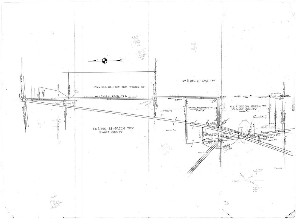
Owner:
National Fireproofing Co.
Description:
Survey includes Mine #12
Primary road:
Mayfair Road
Secondary road:
Aultman Road
Near intersection:
Acreage:
240.0
Survey Locators
Tract list:
Lot list:
Section list:
36
Quarter:
Surveyor
Surveyor number:
Surveyor name:
Company:
Document Data
Scan File Name:
survey_10343.tif
Scan Pages:
3
Drawer location:
20-1-B Folder 006-001