Toggle navigation
Survey Documents
Advanced Search
Supporting Data
Companies
Surveyors
Communities
Original Townships
APIs
Survey Documents API
Tutorial
About
Contact
Search
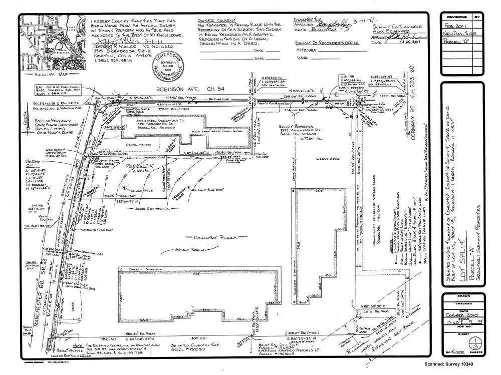
10349
Download survey_10349.tif
GIS Data
Latitude:
41.0098999999999
Longitude:
-81.554443
Identification
Survey identifier:
10349
Context
Original township:
Coventry
Community list:
Surveyed on:
03/29/2011
Description
Owner:
Summit Properties
Description:
split
Primary road:
Manchester Road SR 93
Secondary road:
Near intersection:
Robinson Avenue
Acreage:
0.6917
Survey Locators
Tract list:
15
Lot list:
23
Section list:
Quarter:
Surveyor
Surveyor number:
6620
Surveyor name:
Miller, Jeffrey P.
Company:
Document Data
Scan File Name:
survey_10349.tif
Scan Pages:
1
Drawer location:
003