Toggle navigation
Survey Documents
Advanced Search
Supporting Data
Companies
Surveyors
Communities
Original Townships
APIs
Survey Documents API
Tutorial
About
Contact
Search
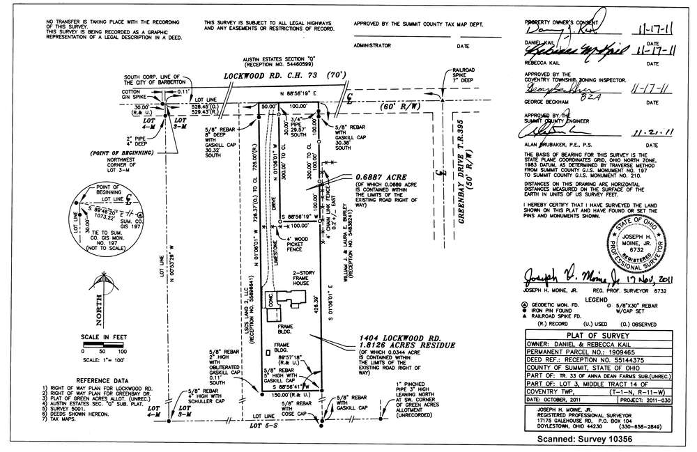
10356
Download survey_10356.tif
GIS Data
Latitude:
40.9987349999998
Longitude:
-81.574205
Identification
Survey identifier:
10356
Context
Original township:
Coventry
Community list:
Surveyed on:
11/22/2011
Description
Owner:
Kail, Daniel and Rebecca
Description:
1404 Lockwood Road - Split
Primary road:
Lockwood Road
Secondary road:
Near intersection:
Greenbay Drive
Acreage:
1.8126
Survey Locators
Tract list:
14 Middle
Lot list:
3
Section list:
Quarter:
Surveyor
Surveyor number:
Surveyor name:
Company:
Joseph H. Moine Jr. Ps
Document Data
Scan File Name:
survey_10356.tif
Scan Pages:
1
Drawer location:
003