Toggle navigation
Survey Documents
Advanced Search
Supporting Data
Companies
Surveyors
Communities
Original Townships
APIs
Survey Documents API
Tutorial
About
Contact
Search
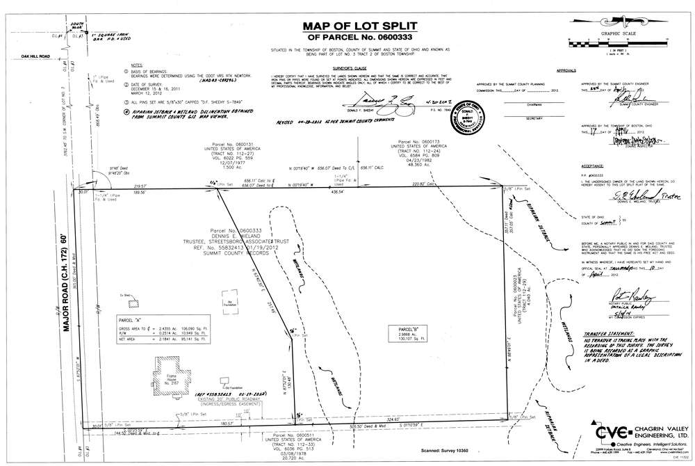
10360
Download survey_10360.TIF
GIS Data
Latitude:
41.2336699999998
Longitude:
-81.57653
Identification
Survey identifier:
10360
Context
Original township:
Boston
Community list:
Surveyed on:
04/24/2012
Description
Owner:
Wieland, Dennis E.
Description:
Lot Split 2167 Major Road
Primary road:
Major Road
Secondary road:
Near intersection:
Oak Hill Road
Acreage:
2.4355
Survey Locators
Tract list:
2
Lot list:
3
Section list:
Quarter:
Surveyor
Surveyor number:
Surveyor name:
Company:
Chagrin Valley Engineering, Ltd.
Document Data
Scan File Name:
survey_10360.TIF
Scan Pages:
1
Drawer location:
003