Toggle navigation
Survey Documents
Advanced Search
Supporting Data
Companies
Surveyors
Communities
Original Townships
APIs
Survey Documents API
Tutorial
About
Contact
Search
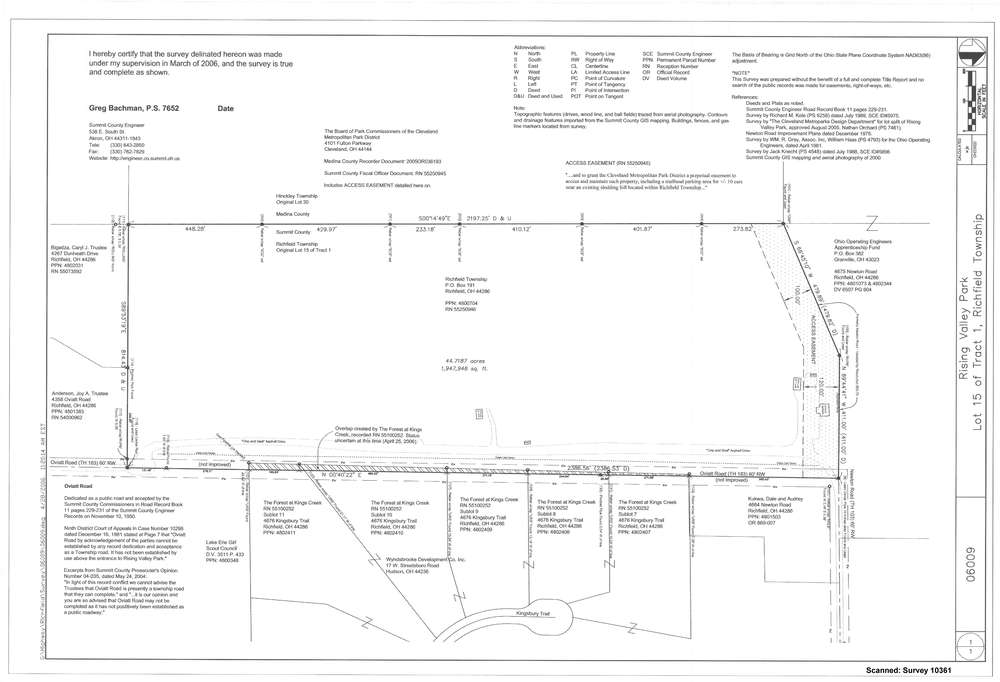
10361
Download survey_10361.TIF
GIS Data
Latitude:
41.2600009999999
Longitude:
-81.683435
Identification
Survey identifier:
10361
Context
Original township:
Richfield
Community list:
Surveyed on:
03/31/2006
Description
Owner:
Richfield Township
Description:
Rising Valley Park
Primary road:
Oviatt
Secondary road:
Newton
Near intersection:
Acreage:
44.7187
Survey Locators
Tract list:
15
Lot list:
1
Section list:
Quarter:
Surveyor
Surveyor number:
Surveyor name:
Company:
County Of Summit Engineer
Document Data
Scan File Name:
survey_10361.TIF
Scan Pages:
1
Drawer location:
003