Toggle navigation
Survey Documents
Advanced Search
Supporting Data
Companies
Surveyors
Communities
Original Townships
APIs
Survey Documents API
Tutorial
About
Contact
Search
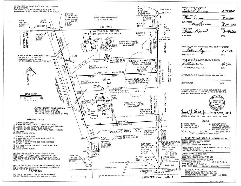
10365
Download survey_10365.tif
GIS Data
Latitude:
40.9935359999999
Longitude:
-81.394143
Identification
Survey identifier:
10365
Context
Original township:
Springfield
Community list:
Surveyed on:
08/10/2012
Description
Owner:
Kresse
Description:
Split and Consolidation
Primary road:
Portage Line Road
Secondary road:
Manning Road
Near intersection:
Acreage:
2.1952
Survey Locators
Tract list:
8
Lot list:
1
Section list:
Quarter:
Surveyor
Surveyor number:
Surveyor name:
Company:
Joseph H. Moine Jr. Ps
Document Data
Scan File Name:
survey_10365.tif
Scan Pages:
1
Drawer location:
003