Toggle navigation
Survey Documents
Advanced Search
Supporting Data
Companies
Surveyors
Communities
Original Townships
APIs
Survey Documents API
Tutorial
About
Contact
Search
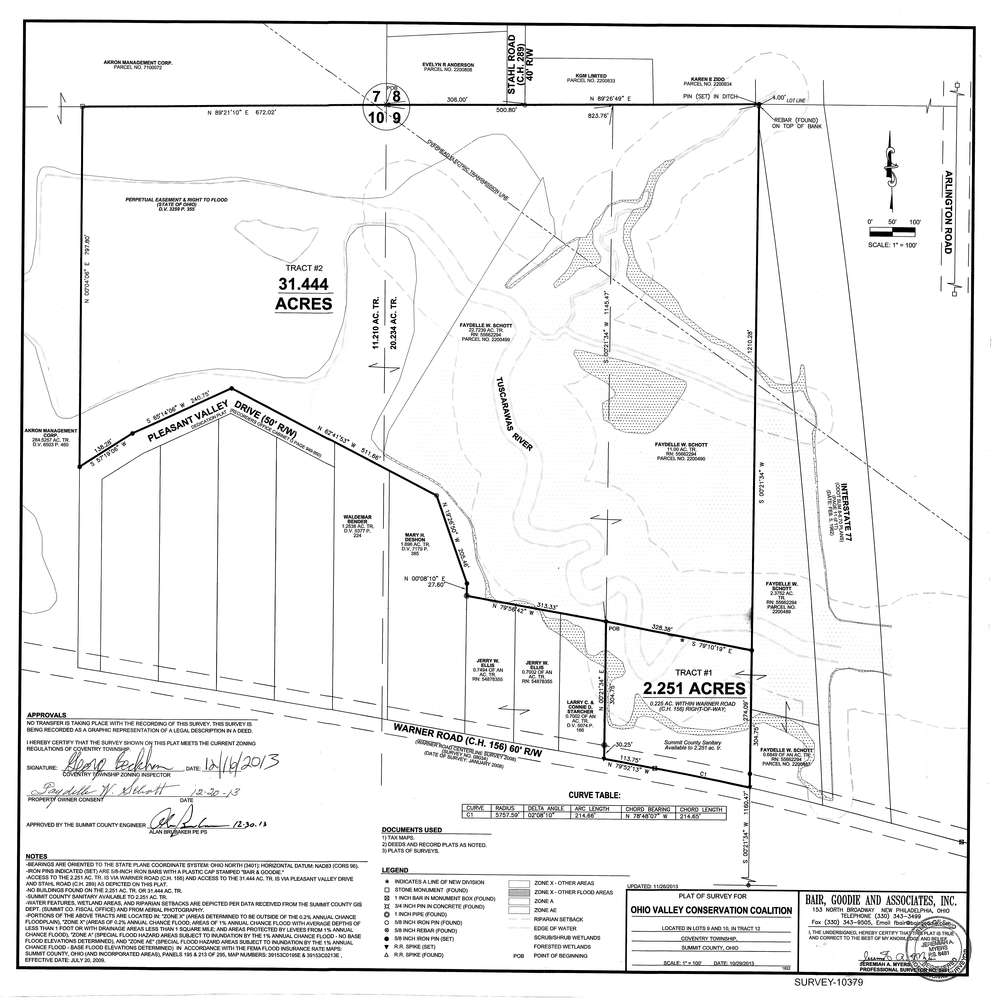
10379
Download survey_10379.tif
GIS Data
Latitude:
41.0093419999998
Longitude:
-81.497569
Identification
Survey identifier:
10379
Context
Original township:
Coventry
Community list:
Surveyed on:
12/30/2013
Description
Owner:
Schott
Description:
Split
Primary road:
Warner Road
Secondary road:
I-77
Near intersection:
Acreage:
2.251
Survey Locators
Tract list:
12
Lot list:
9 and 10
Section list:
Quarter:
Surveyor
Surveyor number:
Surveyor name:
Company:
Document Data
Scan File Name:
survey_10379.tif
Scan Pages:
1
Drawer location:
003