Toggle navigation
Survey Documents
Advanced Search
Supporting Data
Companies
Surveyors
Communities
Original Townships
APIs
Survey Documents API
Tutorial
About
Contact
Search
f2048
Download f2048.tif
GIS Data
Latitude:
41.1324399999999
Longitude:
-81.514328
Identification
Survey identifier:
f2048
Context
Original township:
Portage
Community list:
Surveyed on:
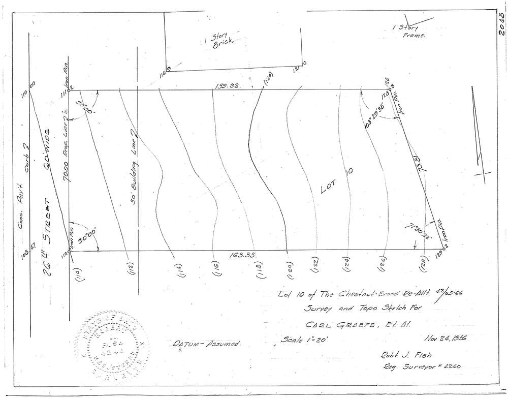
11/24/1956
Description
Owner:
Graefe, carl
Description:
Sublot 10 Chestnut Brood Re-Allt. 42/65-66
Primary road:
twenty-six street
Secondary road:
Sacket
Near intersection:
Falls Avenue
Acreage:
Survey Locators
Tract list:
Lot list:
Section list:
Quarter:
Surveyor
Surveyor number:
Surveyor name:
Company:
Document Data
Scan File Name:
f2048.tif
Scan Pages:
1
Drawer location:
252-255