Toggle navigation
Survey Documents
Advanced Search
Supporting Data
Companies
Surveyors
Communities
Original Townships
APIs
Survey Documents API
Tutorial
About
Contact
Search
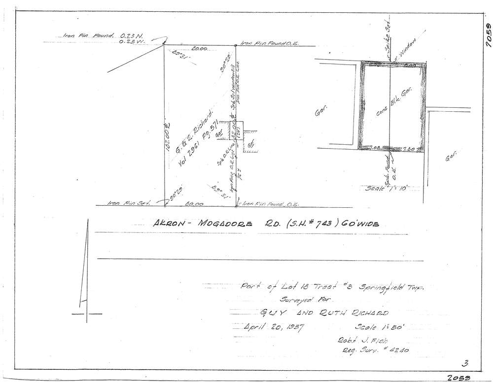
F2059
Download f2059.tif
GIS Data
Latitude:
41.0514839999998
Longitude:
-81.413659
Identification
Survey identifier:
F2059
Context
Original township:
Springfield
Community list:
Surveyed on:
04/20/1957
Description
Owner:
Richard, Guy and Ruth
Description:
Property line survey
Primary road:
Mogadore
Secondary road:
Near intersection:
Acreage:
Survey Locators
Tract list:
8
Lot list:
18
Section list:
Quarter:
Surveyor
Surveyor number:
Surveyor name:
Company:
Document Data
Scan File Name:
f2059.tif
Scan Pages:
1
Drawer location:
252-255