Toggle navigation
Survey Documents
Advanced Search
Supporting Data
Companies
Surveyors
Communities
Original Townships
APIs
Survey Documents API
Tutorial
About
Contact
Search
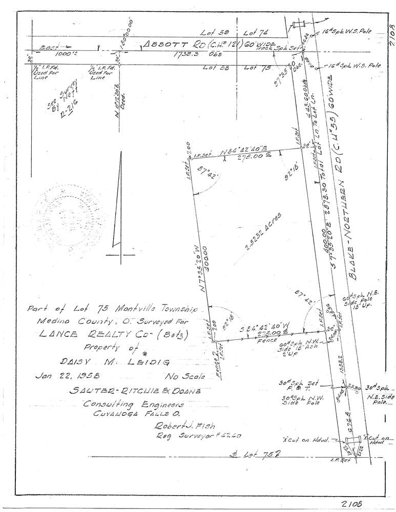
F2108
Download f2108.tif
GIS Data
Latitude:
41.0763749999999
Longitude:
-81.819906
Identification
Survey identifier:
F2108
Context
Original township:
Montville
Community list:
Surveyed on:
01/22/1958
Description
Owner:
Leidig
Description:
Primary road:
Blake-Northern Rd
Secondary road:
Near intersection:
Abbott Rd
Acreage:
2.5232
Survey Locators
Tract list:
Lot list:
75
Section list:
Quarter:
Surveyor
Surveyor number:
Surveyor name:
Company:
Sauter Ritchie & Doane Inc.
Document Data
Scan File Name:
f2108.tif
Scan Pages:
1
Drawer location:
252-255