Toggle navigation
Survey Documents
Advanced Search
Supporting Data
Companies
Surveyors
Communities
Original Townships
APIs
Survey Documents API
Tutorial
About
Contact
Search
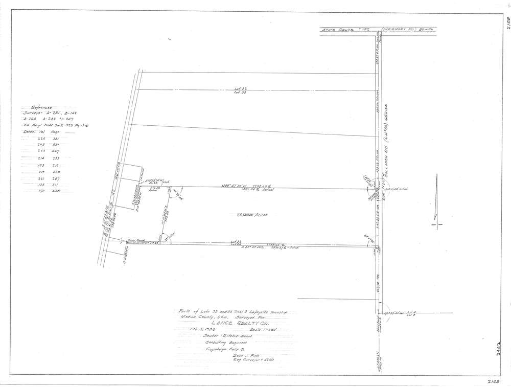
F2109
Download f2109.tif
GIS Data
Latitude:
41.0971089999999
Longitude:
-81.932001
Identification
Survey identifier:
F2109
Context
Original township:
Community list:
Surveyed on:
02/05/1958
Description
Owner:
Description:
Primary road:
Ballasch Rd
Secondary road:
S.R. 42
Near intersection:
S.R. 162
Acreage:
Survey Locators
Tract list:
3
Lot list:
33,34
Section list:
Quarter:
Surveyor
Surveyor number:
Surveyor name:
Company:
Sauter Ritchie & Doane Inc.
Document Data
Scan File Name:
f2109.tif
Scan Pages:
1
Drawer location: