Toggle navigation
Survey Documents
Advanced Search
Supporting Data
Companies
Surveyors
Communities
Original Townships
APIs
Survey Documents API
Tutorial
About
Contact
Search
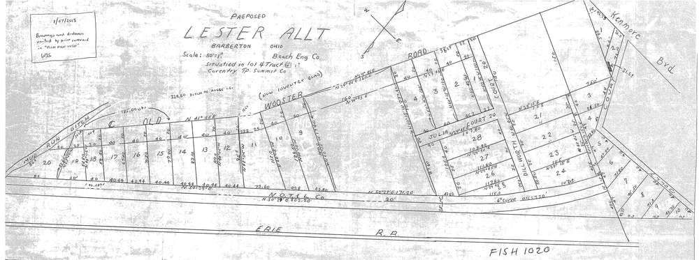
Lester
Download lester_allt_unrecorded.tif
GIS Data
Latitude:
41.0340779999999
Longitude:
-81.57928
Identification
Survey identifier:
Lester
Context
Original township:
Coventry
Community list:
Surveyed on:
01/01/1920
Description
Owner:
Description:
unrecorded allotment
Primary road:
Coventry Road
Secondary road:
formerly Old Wooster Road
Near intersection:
Kenmore Blvd
Acreage:
Survey Locators
Tract list:
4
Lot list:
4
Section list:
Quarter:
Surveyor
Surveyor number:
Surveyor name:
Company:
Document Data
Scan File Name:
lester_allt_unrecorded.tif
Scan Pages:
1
Drawer location:
003