Toggle navigation
Survey Documents
Advanced Search
Supporting Data
Companies
Surveyors
Communities
Original Townships
APIs
Survey Documents API
Tutorial
About
Contact
Search
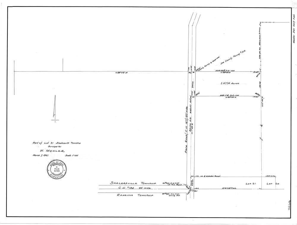
F2217
Download f2217.tif
GIS Data
Latitude:
41.2065559999999
Longitude:
-81.214199
Identification
Survey identifier:
F2217
Context
Original township:
Shalersville
Community list:
Surveyed on:
03/07/1961
Description
Owner:
Mohler
Description:
Primary road:
Peck Rd
Secondary road:
Near intersection:
C.H. 154
Acreage:
2.5775
Survey Locators
Tract list:
Lot list:
21
Section list:
Quarter:
Surveyor
Surveyor number:
Surveyor name:
Company:
Document Data
Scan File Name:
f2217.tif
Scan Pages:
1
Drawer location:
252-255