Toggle navigation
Survey Documents
Advanced Search
Supporting Data
Companies
Surveyors
Communities
Original Townships
APIs
Survey Documents API
Tutorial
About
Contact
Search
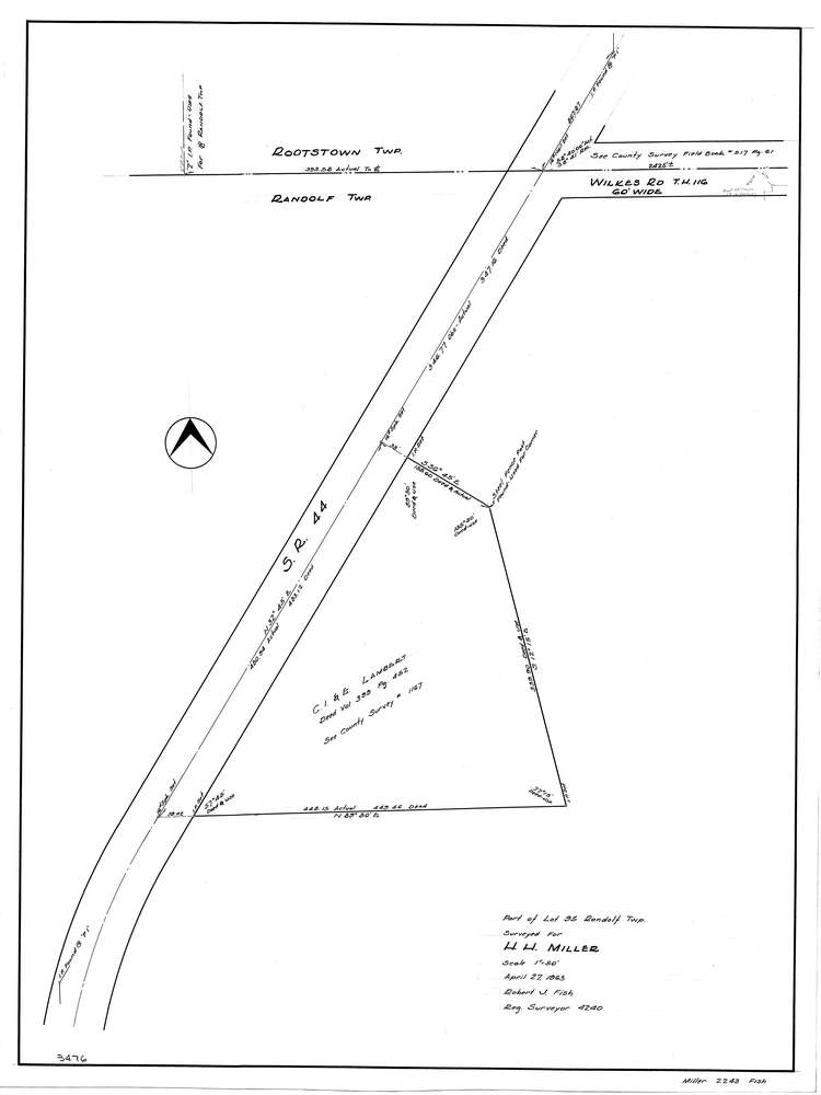
F2243
Download f2243.tif
GIS Data
Latitude:
41.0625599999998
Longitude:
-81.245999
Identification
Survey identifier:
F2243
Context
Original township:
Randolf
Community list:
Surveyed on:
04/27/1963
Description
Owner:
Miller
Description:
Primary road:
S.R. 44
Secondary road:
Near intersection:
Wilkes Rd
Acreage:
Survey Locators
Tract list:
Lot list:
95
Section list:
Quarter:
Surveyor
Surveyor number:
Surveyor name:
Company:
Document Data
Scan File Name:
f2243.tif
Scan Pages:
1
Drawer location:
252-255