Toggle navigation
Survey Documents
Advanced Search
Supporting Data
Companies
Surveyors
Communities
Original Townships
APIs
Survey Documents API
Tutorial
About
Contact
Search
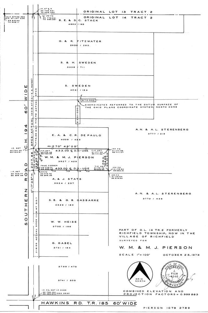
F2789
Download f2789.tif
GIS Data
Latitude:
41.2273449999999
Longitude:
-81.660326
Identification
Survey identifier:
F2789
Context
Original township:
Richfield
Community list:
Surveyed on:
10/25/1978
Description
Owner:
Pierson
Description:
Primary road:
Southern Rd
Secondary road:
Near intersection:
Hawkins Rd
Acreage:
Survey Locators
Tract list:
2
Lot list:
14
Section list:
Quarter:
Surveyor
Surveyor number:
Surveyor name:
Company:
Document Data
Scan File Name:
f2789.tif
Scan Pages:
1
Drawer location:
252-255