Toggle navigation
Survey Documents
Advanced Search
Supporting Data
Companies
Surveyors
Communities
Original Townships
APIs
Survey Documents API
Tutorial
About
Contact
Search
F2800 3 pages scanned, please download to view all scans
Download image.tif
GIS Data
Latitude:
41.2700979999999
Longitude:
-81.468129
Identification
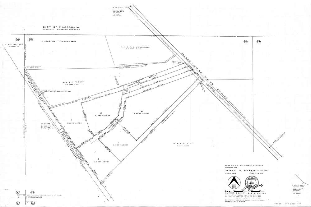
Survey identifier:
F2800
Context
Original township:
Hudson
Community list:
Surveyed on:
04/01/1979
Description
Owner:
Baker
Description:
C & G Survey
Primary road:
Valley View Rd
Secondary road:
Near intersection:
Acreage:
Survey Locators
Tract list:
Lot list:
92
Section list:
Quarter:
Surveyor
Surveyor number:
Surveyor name:
Company:
Document Data
Scan File Name:
image.tif
Scan Pages:
3
Drawer location:
252-255