Toggle navigation
Survey Documents
Advanced Search
Supporting Data
Companies
Surveyors
Communities
Original Townships
APIs
Survey Documents API
Tutorial
About
Contact
Search
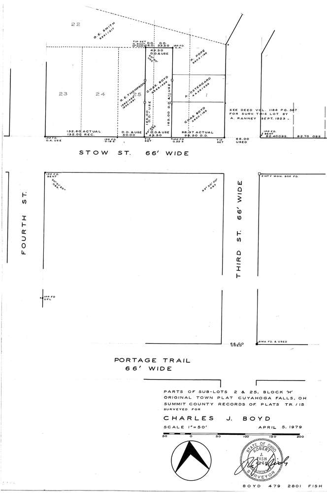
F2801
Download f2801.tif
GIS Data
Latitude:
41.1381119999999
Longitude:
-81.485955
Identification
Survey identifier:
F2801
Context
Original township:
Community list:
Surveyed on:
04/05/1979
Description
Owner:
Boyd
Description:
S/L 2, 25 Block H Original Town Plat
Primary road:
Stow St
Secondary road:
Portage Trail
Near intersection:
Third St
Acreage:
Survey Locators
Tract list:
Lot list:
Section list:
Quarter:
Surveyor
Surveyor number:
Surveyor name:
Company:
Document Data
Scan File Name:
f2801.tif
Scan Pages:
1
Drawer location:
252-255