Toggle navigation
Survey Documents
Advanced Search
Supporting Data
Companies
Surveyors
Communities
Original Townships
APIs
Survey Documents API
Tutorial
About
Contact
Search
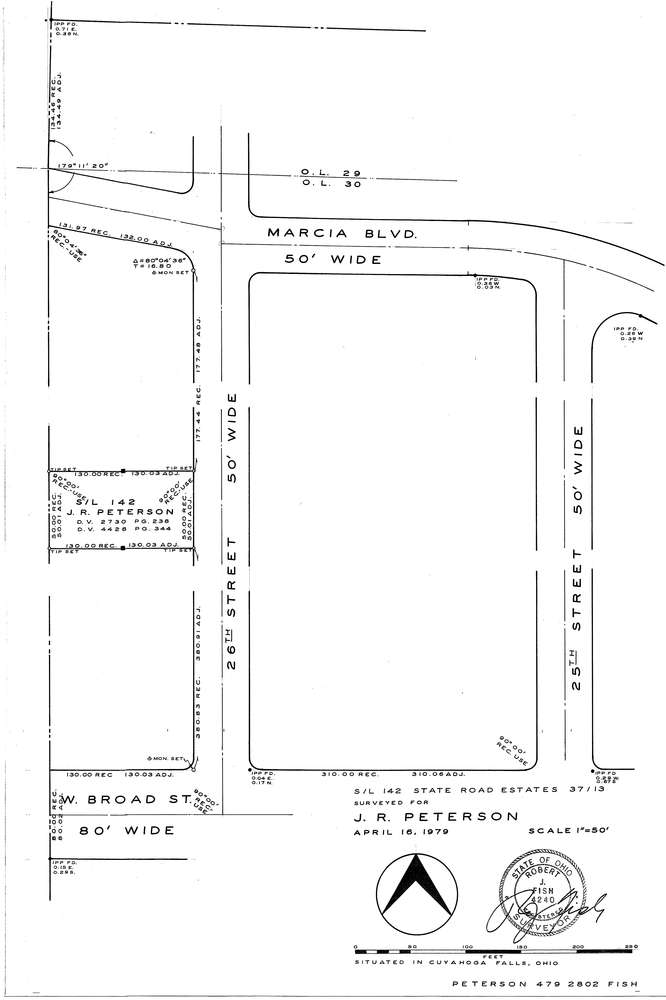
F2802
Download f2802.tif
GIS Data
Latitude:
41.1354899999998
Longitude:
-81.513174
Identification
Survey identifier:
F2802
Context
Original township:
Community list:
Surveyed on:
04/16/1979
Description
Owner:
Peterson
Description:
S/L 142 State Road Estates
Primary road:
26th St
Secondary road:
Near intersection:
Broad St
Acreage:
Survey Locators
Tract list:
Lot list:
Section list:
Quarter:
Surveyor
Surveyor number:
Surveyor name:
Company:
Document Data
Scan File Name:
f2802.tif
Scan Pages:
1
Drawer location:
252-255