Toggle navigation
Survey Documents
Advanced Search
Supporting Data
Companies
Surveyors
Communities
Original Townships
APIs
Survey Documents API
Tutorial
About
Contact
Search
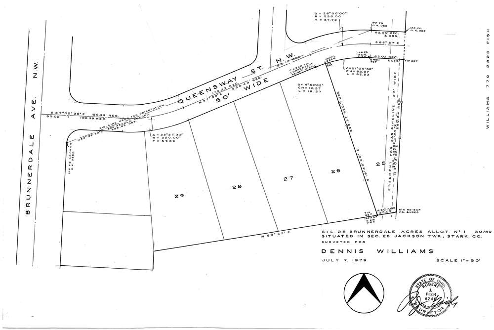
F2820
Download f2820.tif
GIS Data
Latitude:
40.8402829999998
Longitude:
-81.460211
Identification
Survey identifier:
F2820
Context
Original township:
Jackson
Community list:
Surveyed on:
07/07/1979
Description
Owner:
Williams
Description:
S/L 25 Brunnerdale Acres Allot. No.1
Primary road:
Queensway St
Secondary road:
Near intersection:
Brunnerdale Ave
Acreage:
Survey Locators
Tract list:
Lot list:
Section list:
Quarter:
Surveyor
Surveyor number:
Surveyor name:
Company:
Document Data
Scan File Name:
f2820.tif
Scan Pages:
1
Drawer location:
252-255