Toggle navigation
Survey Documents
Advanced Search
Supporting Data
Companies
Surveyors
Communities
Original Townships
APIs
Survey Documents API
Tutorial
About
Contact
Search
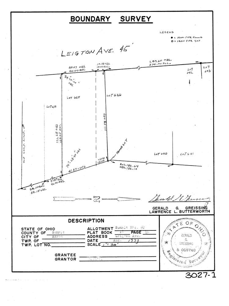
3027-1
Download lotsplits3027_1.tif
GIS Data
Latitude:
41.0506349999999
Longitude:
-81.549464
Identification
Survey identifier:
3027-1
Context
Original township:
Akron
Community list:
Akron
Surveyed on:
08/01/1973
Description
Owner:
Bachtel
Description:
Summit Heights No 2 Allotment Pb 18 Pg 10
Primary road:
Leighton Ave
Secondary road:
Near intersection:
Indian Trail
Acreage:
Survey Locators
Tract list:
Lot list:
Section list:
Quarter:
Surveyor
Surveyor number:
5746
Surveyor name:
Greissing, Gerald G.
Company:
Document Data
Scan File Name:
lotsplits3027_1.tif
Scan Pages:
1
Drawer location: