Toggle navigation
Survey Documents
Advanced Search
Supporting Data
Companies
Surveyors
Communities
Original Townships
APIs
Survey Documents API
Tutorial
About
Contact
Search
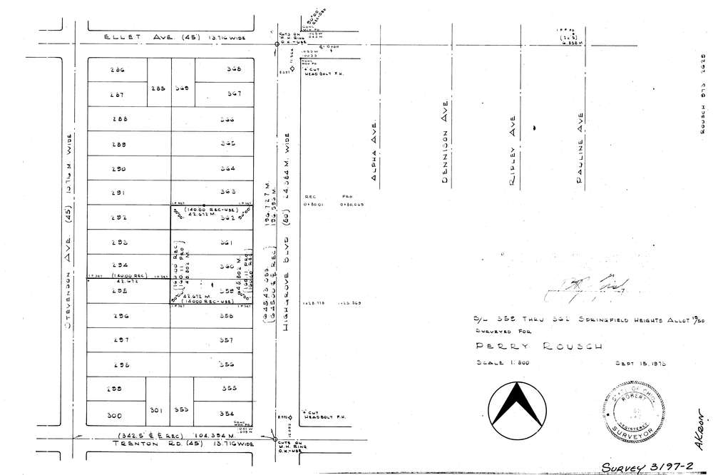
3197-2
Download lotsplits3197_2.tif
GIS Data
Latitude:
41.0492589999999
Longitude:
-81.431394
Identification
Survey identifier:
3197-2
Context
Original township:
Springfield
Community list:
Akron
Surveyed on:
09/15/1973
Description
Owner:
Rousch
Description:
Lots 359 362 Springfield Heights Allotment
Primary road:
Highgrove Blvd
Secondary road:
Stevenson Ave
Near intersection:
Trenton Rd
Acreage:
Survey Locators
Tract list:
Lot list:
Section list:
Quarter:
Surveyor
Surveyor number:
4240
Surveyor name:
Fish, Robert J.
Company:
Document Data
Scan File Name:
lotsplits3197_2.tif
Scan Pages:
1
Drawer location: