Toggle navigation
Survey Documents
Advanced Search
Supporting Data
Companies
Surveyors
Communities
Original Townships
APIs
Survey Documents API
Tutorial
About
Contact
Search
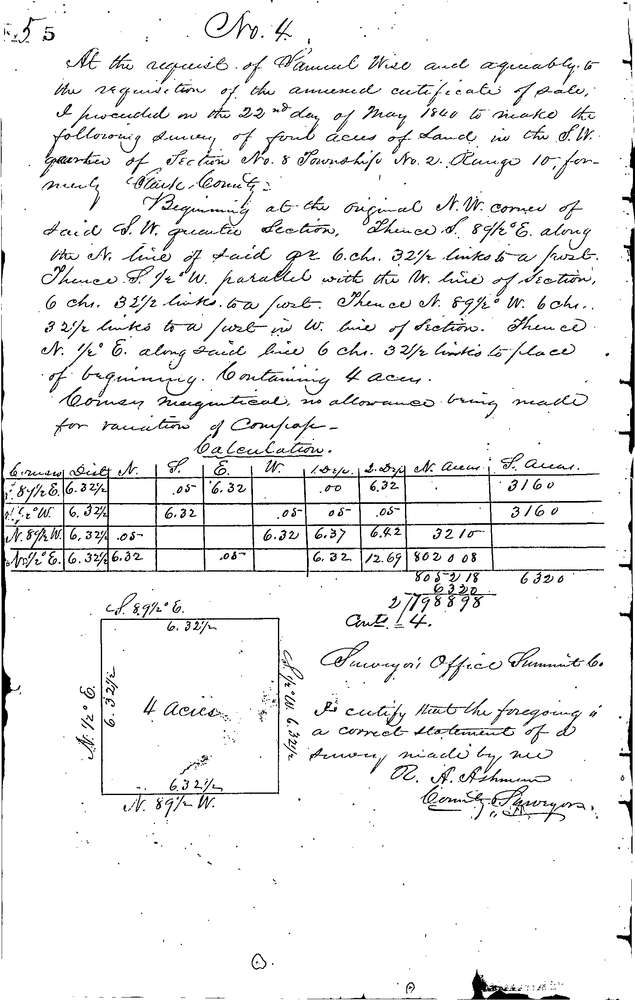
0004
Download 0004.TIF
GIS Data
Latitude:
40.9735599999999
Longitude:
-81.62969
Identification
Survey identifier:
0004
Context
Original township:
Franklin
Community list:
New Franklin
Surveyed on:
05/22/1840
Description
Owner:
Wise
Description:
4.0 AC. S.W. CORNER OF S.W. 1/4 SEC.
Primary road:
S. Cleveland Massillon Rd
Secondary road:
Near intersection:
Vanderhoof Rd
Acreage:
4.0
Survey Locators
Tract list:
Lot list:
Section list:
8
Quarter:
SW
Surveyor
Surveyor number:
Surveyor name:
Company:
Summit County Surveyor
Document Data
Scan File Name:
0004.TIF
Scan Pages:
1
Drawer location:
Survey Book 1 Pg 5