Toggle navigation
Survey Documents
Advanced Search
Supporting Data
Companies
Surveyors
Communities
Original Townships
APIs
Survey Documents API
Tutorial
About
Contact
Search
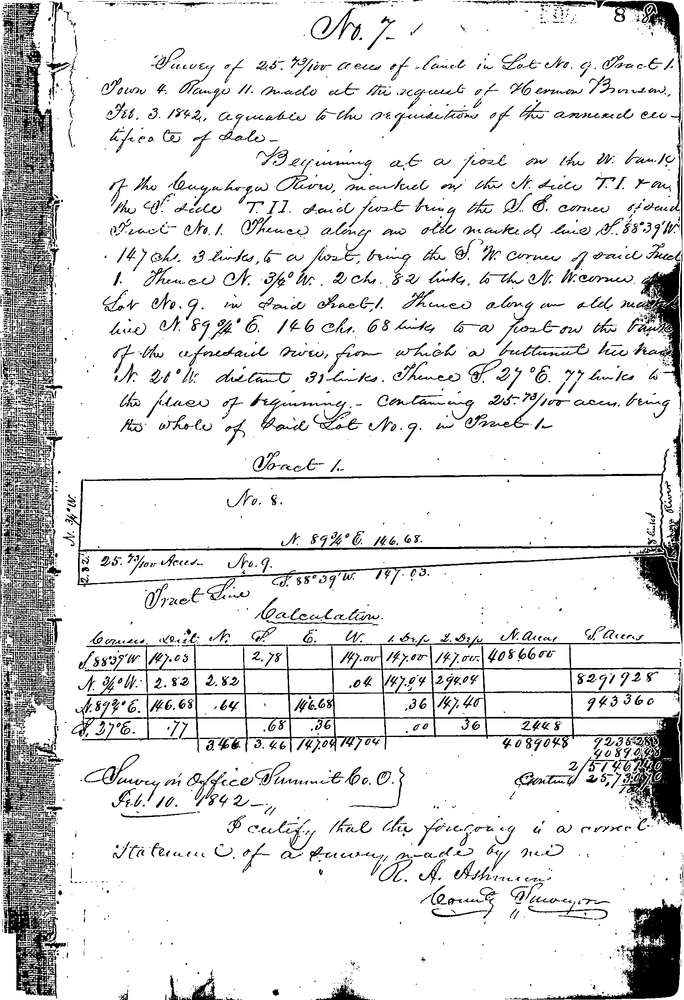
0007
Download 0007.TIF
GIS Data
Latitude:
41.2438099999999
Longitude:
-81.58081
Identification
Survey identifier:
0007
Context
Original township:
Boston
Community list:
Surveyed on:
02/03/1842
Description
Owner:
Bronson
Description:
All of lot 9 south side of Tract 1
Primary road:
SR 303
Secondary road:
Near intersection:
Acreage:
25.73
Survey Locators
Tract list:
1
Lot list:
9
Section list:
Quarter:
Surveyor
Surveyor number:
Surveyor name:
Company:
Summit County Surveyor
Document Data
Scan File Name:
0007.TIF
Scan Pages:
1
Drawer location:
Survey Book 1 Pg 8