Toggle navigation
Survey Documents
Advanced Search
Supporting Data
Companies
Surveyors
Communities
Original Townships
APIs
Survey Documents API
Tutorial
About
Contact
Search
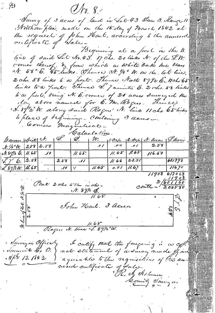
0008
Download 0008.TIF
GIS Data
Latitude:
41.1827299999999
Longitude:
-81.52459
Identification
Survey identifier:
0008
Context
Original township:
Northampton
Community list:
Surveyed on:
03/13/1842
Description
Owner:
Hart
Description:
3.0 AC. 17.2 CH. N. OF S.W. COR. LOT
Primary road:
Steeles Corners Rd
Secondary road:
Near intersection:
Haas Rd
Acreage:
3.0
Survey Locators
Tract list:
Lot list:
43
Section list:
Quarter:
Surveyor
Surveyor number:
Surveyor name:
Company:
Summit County Surveyor
Document Data
Scan File Name:
0008.TIF
Scan Pages:
1
Drawer location:
Survey Book 1 Pg 9