Toggle navigation
Survey Documents
Advanced Search
Supporting Data
Companies
Surveyors
Communities
Original Townships
APIs
Survey Documents API
Tutorial
About
Contact
Search
0012 2 pages scanned, please download to view all scans
Download 0012.tif
GIS Data
Latitude:
40.9270799999998
Longitude:
-81.57163
Identification
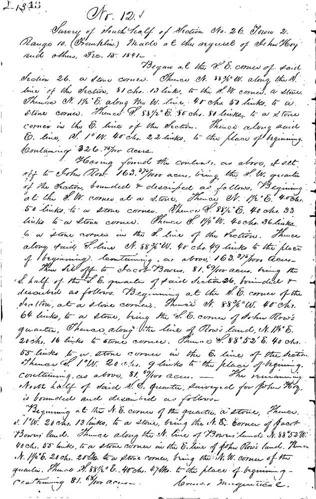
Survey identifier:
0012
Context
Original township:
Franklin
Community list:
New Franklin
Surveyed on:
12/20/1841
Description
Owner:
Hoy, Bowers and Row
Description:
SOUTH 1/2 OF SEC. 26
Primary road:
Hampsher Rd
Secondary road:
Manchester Rd
Near intersection:
Acreage:
326.75
Survey Locators
Tract list:
Lot list:
Section list:
26
Quarter:
Surveyor
Surveyor number:
Surveyor name:
Company:
Summit County Surveyor
Document Data
Scan File Name:
0012.tif
Scan Pages:
2
Drawer location:
Survey Book 1 Pg 13