Toggle navigation
Survey Documents
Advanced Search
Supporting Data
Companies
Surveyors
Communities
Original Townships
APIs
Survey Documents API
Tutorial
About
Contact
Search
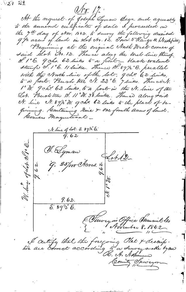
0017
Download 0017.TIF
GIS Data
Latitude:
41.3432499999998
Longitude:
-81.50768
Identification
Survey identifier:
0017
Context
Original township:
Northfield
Community list:
Northfield
Surveyed on:
11/08/1842
Description
Owner:
Lyman
Description:
9.25 ACRES IN THE N.W. CORNER OF LOT
Primary road:
N. Bedford Rd
Secondary road:
Near intersection:
Acreage:
9.25
Survey Locators
Tract list:
Lot list:
12
Section list:
Quarter:
Surveyor
Surveyor number:
Surveyor name:
Company:
Summit County Surveyor
Document Data
Scan File Name:
0017.TIF
Scan Pages:
1
Drawer location:
Survey Book 1 Pg 21