Toggle navigation
Survey Documents
Advanced Search
Supporting Data
Companies
Surveyors
Communities
Original Townships
APIs
Survey Documents API
Tutorial
About
Contact
Search
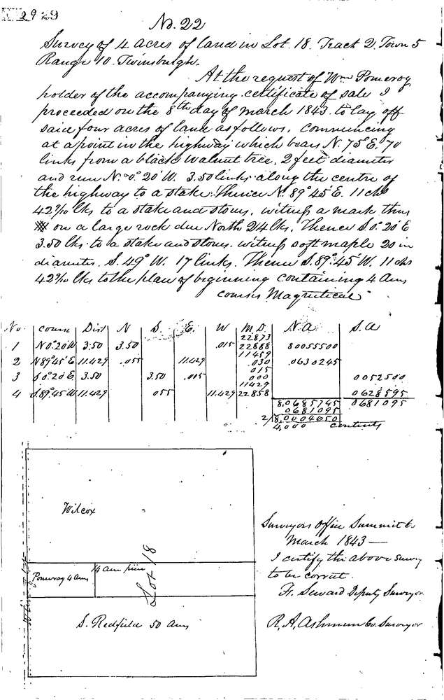
22
Download 0022.TIF
GIS Data
Latitude:
41.3280099999999
Longitude:
-81.43838
Identification
Survey identifier:
22
Context
Original township:
Twinsburg
Community list:
Twinsburg
Surveyed on:
03/05/2015
Description
Owner:
Pomeroy
Description:
4.0 ACRES ON WEST LINE OF LOT
Primary road:
Darrow Rd
Secondary road:
Near intersection:
Acreage:
4.0
Survey Locators
Tract list:
2
Lot list:
18
Section list:
Quarter:
Surveyor
Surveyor number:
Surveyor name:
Company:
Summit County Surveyor
Document Data
Scan File Name:
0022.TIF
Scan Pages:
1
Drawer location:
Survey Book 1 Pg 29