Toggle navigation
Survey Documents
Advanced Search
Supporting Data
Companies
Surveyors
Communities
Original Townships
APIs
Survey Documents API
Tutorial
About
Contact
Search
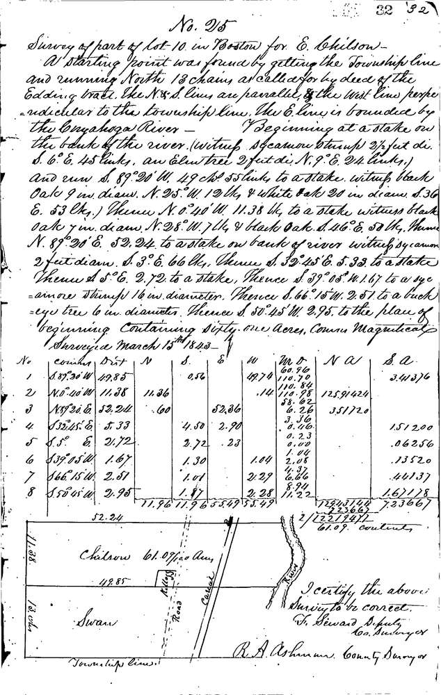
0025
Download 0025.TIF
GIS Data
Latitude:
41.2487199999999
Longitude:
-81.49103
Identification
Survey identifier:
0025
Context
Original township:
Boston
Community list:
Boston
Surveyed on:
03/15/1843
Description
Owner:
Chilson
Description:
61.09 AC. 13 CH N. OF TWP. LINE & W. OF RIVER
Primary road:
Secondary road:
Near intersection:
Acreage:
61.09
Survey Locators
Tract list:
9
Lot list:
4
Section list:
Quarter:
Surveyor
Surveyor number:
Surveyor name:
Company:
Summit County Surveyor
Document Data
Scan File Name:
0025.TIF
Scan Pages:
1
Drawer location:
Survey Book 1 Pg 32