Toggle navigation
Survey Documents
Advanced Search
Supporting Data
Companies
Surveyors
Communities
Original Townships
APIs
Survey Documents API
Tutorial
About
Contact
Search
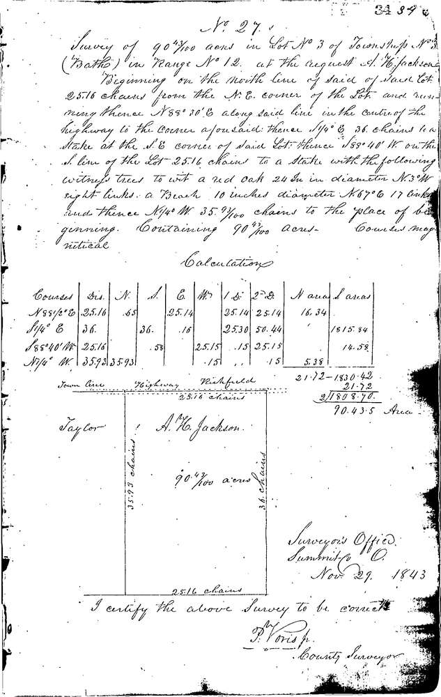
0027
Download 0027.TIF
GIS Data
Latitude:
41.2013699999999
Longitude:
-81.65673
Identification
Survey identifier:
0027
Context
Original township:
Bath
Community list:
Bath
Surveyed on:
11/29/1843
Description
Owner:
Jackson
Description:
90.43 ACRES IN N.E. CORNER LOT
Primary road:
Everett Rd
Secondary road:
Near intersection:
Acreage:
90.43
Survey Locators
Tract list:
Lot list:
3
Section list:
Quarter:
Surveyor
Surveyor number:
Surveyor name:
Company:
Summit County Surveyor
Document Data
Scan File Name:
0027.TIF
Scan Pages:
1
Drawer location:
Survey Book 1 Pg 34