Toggle navigation
Survey Documents
Advanced Search
Supporting Data
Companies
Surveyors
Communities
Original Townships
APIs
Survey Documents API
Tutorial
About
Contact
Search
0036
Download 0036.TIF
GIS Data
Latitude:
41.0781599999998
Longitude:
-81.51843
Identification
Survey identifier:
0036
Context
Original township:
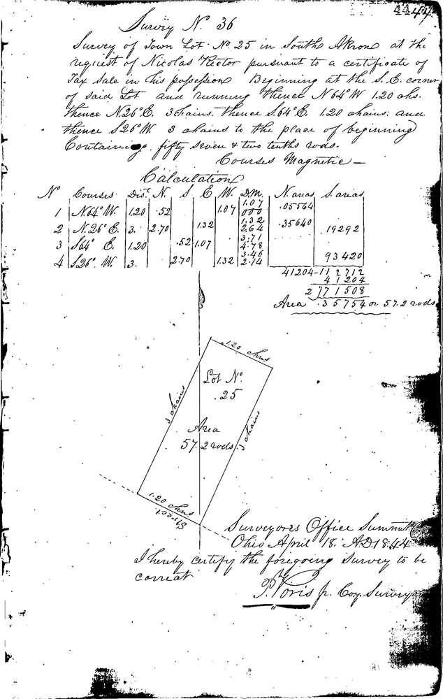
Akron
Community list:
Akron
Surveyed on:
04/18/1844
Description
Owner:
Rector
Description:
Plat of Akron lot 25
Primary road:
State St
Secondary road:
Near intersection:
Acreage:
0.36
Survey Locators
Tract list:
7
Lot list:
Section list:
Quarter:
Surveyor
Surveyor number:
Surveyor name:
Company:
Summit County Surveyor
Document Data
Scan File Name:
0036.TIF
Scan Pages:
1
Drawer location:
Survey Book 1 Pg 44