Toggle navigation
Survey Documents
Advanced Search
Supporting Data
Companies
Surveyors
Communities
Original Townships
APIs
Survey Documents API
Tutorial
About
Contact
Search
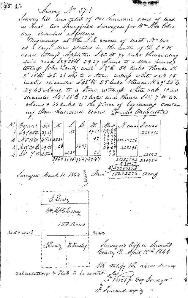
0037
Download 0037.TIF
GIS Data
Latitude:
40.9943599999999
Longitude:
-81.47747
Identification
Survey identifier:
0037
Context
Original township:
Springfield
Community list:
Springfield
Surveyed on:
04/11/1844
Description
Owner:
McChesney
Description:
100.0 ACRES IN SOUTH END OF TRACT
Primary road:
Secondary road:
Near intersection:
Acreage:
100.0
Survey Locators
Tract list:
2
Lot list:
Section list:
Quarter:
Surveyor
Surveyor number:
Surveyor name:
Company:
Summit County Surveyor
Document Data
Scan File Name:
0037.TIF
Scan Pages:
1
Drawer location:
Survey Book 1 Pg 45