Toggle navigation
Survey Documents
Advanced Search
Supporting Data
Companies
Surveyors
Communities
Original Townships
APIs
Survey Documents API
Tutorial
About
Contact
Search
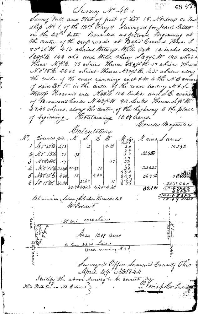
0040
Download 0040.TIF
GIS Data
Latitude:
41.0502399999998
Longitude:
-81.6451
Identification
Survey identifier:
0040
Context
Original township:
Norton
Community list:
Norton
Surveyed on:
04/29/1844
Description
Owner:
Gillett
Description:
10.07 ACRES FROM N.E. CORNER OF LOT
Primary road:
Secondary road:
Near intersection:
Acreage:
10.07
Survey Locators
Tract list:
Lot list:
15
Section list:
Quarter:
Surveyor
Surveyor number:
Surveyor name:
Company:
Summit County Surveyor
Document Data
Scan File Name:
0040.TIF
Scan Pages:
1
Drawer location:
Survey Book 1 Pg 48