Toggle navigation
Survey Documents
Advanced Search
Supporting Data
Companies
Surveyors
Communities
Original Townships
APIs
Survey Documents API
Tutorial
About
Contact
Search
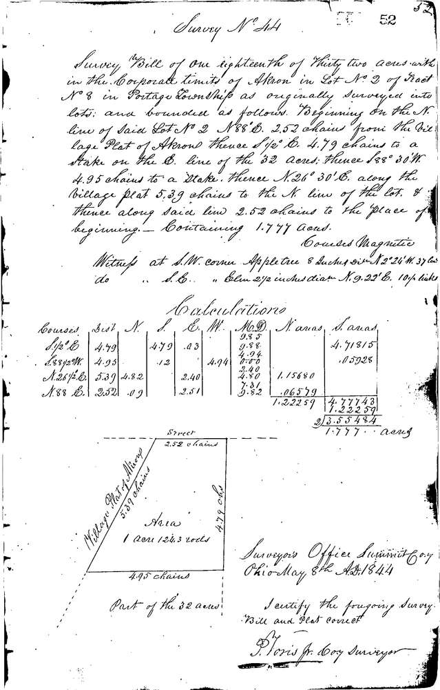
0044
Download 0044.tif
GIS Data
Latitude:
41.0724099999998
Longitude:
-81.52004
Identification
Survey identifier:
0044
Context
Original township:
Portage
Community list:
Akron
Surveyed on:
05/08/1844
Description
Owner:
Description:
ALONG N. LINE OF LOT E. OF PLAT OF AKRON
Primary road:
Secondary road:
Near intersection:
Acreage:
1.777
Survey Locators
Tract list:
8
Lot list:
2
Section list:
Quarter:
Surveyor
Surveyor number:
Surveyor name:
Company:
Summit County Surveyor
Document Data
Scan File Name:
0044.tif
Scan Pages:
1
Drawer location:
Survey Book 1 Pg 52