Toggle navigation
Survey Documents
Advanced Search
Supporting Data
Companies
Surveyors
Communities
Original Townships
APIs
Survey Documents API
Tutorial
About
Contact
Search
0047 2 pages scanned, please download to view all scans
Download 055056.tif
GIS Data
Latitude:
41.0259599999998
Longitude:
-81.63025
Identification
Survey identifier:
0047
Context
Original township:
Norton
Community list:
Norton
Surveyed on:
08/10/1845
Description
Owner:
Description:
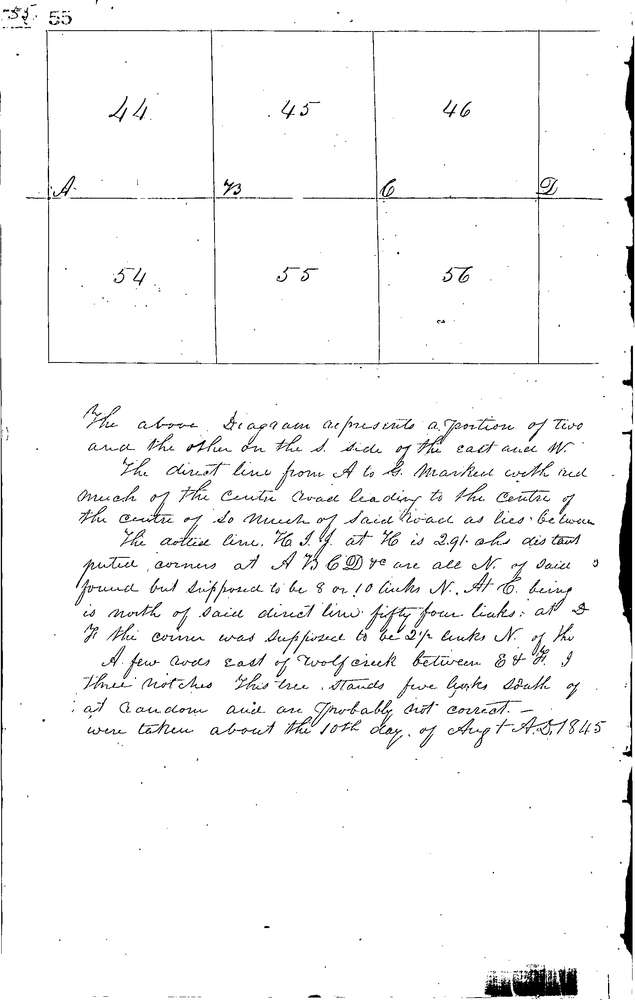
DIVIDING LINE BETWEEN LOTS ACROSS TWP.
Primary road:
Secondary road:
Near intersection:
Acreage:
Survey Locators
Tract list:
Lot list:
44-50, 54-60
Section list:
Quarter:
Surveyor
Surveyor number:
Surveyor name:
Company:
Summit County Surveyor
Document Data
Scan File Name:
055056.tif
Scan Pages:
2
Drawer location:
Survey Book 1 Pg 55