Toggle navigation
Survey Documents
Advanced Search
Supporting Data
Companies
Surveyors
Communities
Original Townships
APIs
Survey Documents API
Tutorial
About
Contact
Search
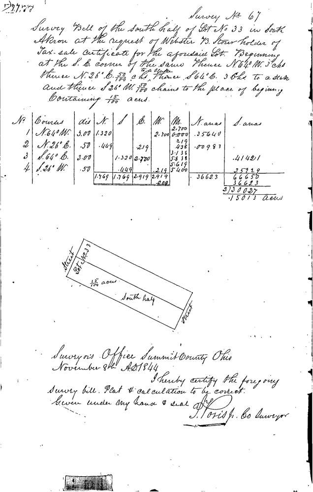
0067
Download 0067.TIF
GIS Data
Latitude:
41.0772399999999
Longitude:
-81.51821
Identification
Survey identifier:
0067
Context
Original township:
Akron
Community list:
Akron
Surveyed on:
11/08/1844
Description
Owner:
Stow
Description:
SOUTH HALF OF LOT
Primary road:
Secondary road:
Near intersection:
Acreage:
0.15
Survey Locators
Tract list:
Lot list:
33
Section list:
Quarter:
Surveyor
Surveyor number:
Surveyor name:
Company:
Summit County Surveyor
Document Data
Scan File Name:
0067.TIF
Scan Pages:
1
Drawer location:
Survey Book 1 Pg 77